Franklin County
|
The “moonshine capital” of the world that helped to spawn stock-car racing in its earlier days, Franklin County is Virginia’s seventh largest county and the home to a growing population in the Smith Mountain Lake area on the county’s northeastern border. Like Bedford County, Franklin County straddles the Blue Ridge Mountains on its rugged western flank and the rolling Virginia Piedmont on its eastern half. All of the county drains into the Roanoke River watershed.
A major agricultural producer, Franklin County knows cows, being second in the state in both total numbers of cows and corn silage production. The Blue Ridge Parkway sits high on the county’s western edge, with overlooks offering views of the county’s tallest peak, Cahas Mountain (3,570 ft.) and the county’s rolling hills. |
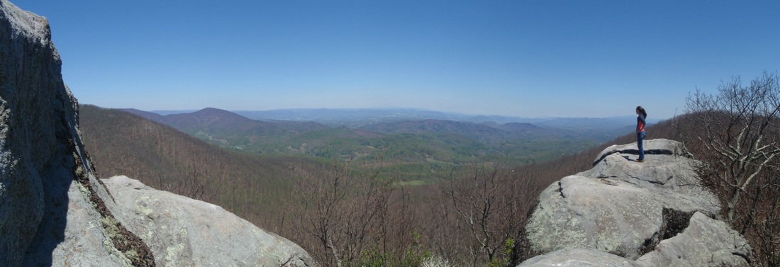
The view looking north across the Roanoke Valley from Table Rock on top of Cahas Mountain in Franklin County. The land to the right of the woman in the picture is protected with a BRLC conservation agreement.
The Blue Ridge Land Conservancy protects more than 1,600 acres of land in Franklin County and more than 11 miles of streams with 15 conservation agreements, ranging from the rocky eastern peak of Cahas Mountain to the banks of the Roanoke River.
|


